La Libertad (La Libertad)
La Libertad (English: Liberty) is a municipality in the La Libertad Department of El Salvador. It had a population of 35,997 inhabitants in 2007 according to the official census of that year. It is one of the main tourist attractions in the country.
In 1770 this area was referred to by Pedro Cortes, the Archbishop of Guatemala (1776–1779), as the "hacienda Tepeahua", one of the largest estates in the parish of San Jacinto. The region was known as Tepehua, a name derived from a Nahuatl expression meaning "mountain of the oak trees", before the Congress of the Federal Republic of Central America authorized the name "Puerto de La Libertad" (Port of Freedom) on February 24, 1824. The national assembly chartered commercial trade on the Pacific coast in 1831, and the first steamboat arrived at La Libertad on June 7, 1857.
La Libertad was incorporated as a village by an Executive decree of July 19, 1858, which was approved by the Congress on February 11, 1859. This was done to relieve the community's excessive dependence on the town of Huizúcar, located at a considerable distance and connected by bad roads.
The town became part of the department of La Libertad on January 28, 1865, and by 1869 had a population of 266 inhabitants. On May 4, 1867, the Salvadoran government awarded the contract for construction of an iron pier, which opened on October 7, 1869. Prior to this, barges were unloaded by securing them with mooring lines. The Salvadoran government enfranchised La Libertad as a villa (town) on March 10, 1874, and as a ciudad (city) on 23 August 1957. The telegraph line between San Salvador and the port was inaugurated on April 27, 1870.
The municipality covers an area of 162 km² and its highest elevation is 10m above sea level. The local economy is based on agriculture and the service sector. The fiestas patronales (patron saint festivals) are celebrated in December in honor of the Immaculate Conception.
Map - La Libertad (La Libertad)
Map
Country - El_Salvador
 |
 |
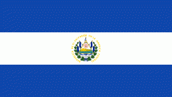
| Flag of El Salvador | |
Among the Mesoamerican nations that historically controlled the region are the Lenca (after 600 AD), the Mayans, and then the Cuzcatlecs. Archaeological monuments also suggest an early Olmec presence around the first millennium BC. In the beginning of the 16th century, the Spanish Empire conquered the Central American territory, incorporating it into the Viceroyalty of New Spain ruled from Mexico City. However the Viceroyalty of New Spain had little to no influence in the daily affairs of the isthmus, which was colonized in 1524. In 1609, the area was declared the Captaincy General of Guatemala by the Spanish, which included the territory that would become El Salvador until its independence from Spain in 1821. It was forcibly incorporated into the First Mexican Empire, then seceded, joining the Federal Republic of Central America in 1823. When the federation dissolved in 1841, El Salvador became a sovereign state, then formed a short-lived union with Honduras and Nicaragua called the Greater Republic of Central America, which lasted from 1895 to 1898.
Currency / Language
| ISO | Currency | Symbol | Significant figures |
|---|---|---|---|
| SVC | Salvadoran colón | 2 | |
| USD | United States dollar | $ | 2 |
| ISO | Language |
|---|---|
| ES | Spanish language |


